
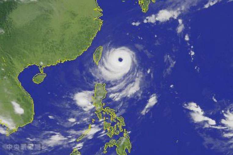
TAIPEI: Evacuations were stepped up in Taiwan Monday as 'super typhoon' Dujuan swirled towards the island, gathering strength on its approach to the east coast.
Torrential rains and high winds are forecast across Taiwan from Monday afternoon, with landfall predicted around 11:00 pm (1500 GMT).
Crashing waves were already battering the northeastern coast by midday and fishing boats have been called back to shore.
Taiwan's weather bureau upgraded Dujuan to a "strong typhoon" Sunday -- its top category.
Other regional weather bureaus, including the Hong Kong Observatory, categorised it as a "super typhoon" as it intensified to reach gusts of 227 kilometres (141 miles) per hour.
"The whole of the island should heighten vigilance against severe winds and torrential rains," a spokesman for Taiwan's Central Weather Bureau said.
Almost 3,000 people, most of them tourists, were evacuated Sunday from Taiwan's Green Island and Orchid Island -- popular with visitors.
Around 4,000 more were moved Monday ahead of the storm.
New Taipei City Mayor Eric Chu said they were from vulnerable areas, including the hot spring town of Wulai, just outside Taipei.
"In areas that could become isolated during the typhoon, sufficient rescue and communications equipment will be deployed in advance. We hope residents can cooperate with us," said Chu.
Wulai was hit hard by Typhoon Soudelor in August with some residents unable to return home for weeks.
Aboriginal mountain communities are particularly at risk during typhoons, often hit by flooding and mudslides.
Some are still cleaning up after Soudelor left a trail of destruction.
AFP


